Quick answer
Choose the mapping app and region before you leave, download more area than the route itself, confirm the map is available without a connection, and carry a second way to orient yourself. Offline maps preserve downloaded map data; they do not guarantee every routing, traffic, trail, or emergency feature will work without signal.
An offline map is a preparation task, not a button you press at the trailhead. Download the map while you have a reliable connection, include the area around the route, and then prove that the important parts still work with connectivity disabled. This guide is for hikers who want a practical backup for weak or absent mobile coverage. It does not replace local safety advice, weather checks, route-closure information, or the judgment to turn around.
Choose the map and the area before you leave
Start with the route, not the app. Mark the trailhead, every junction, the destination, likely rest points, and at least one sensible exit. Then include the roads or paths you might use if you shorten the trip. A narrow download that covers only the line on your screen can fail when the route changes.
Google’s official Maps help explains that an offline area can be selected around a place or drawn as a custom rectangle. It also warns that offline availability varies by country or region. For driving, the entire route must fit inside the downloaded area; offline transit, walking, and cycling directions may not be available, and traffic or alternate-route data is unavailable. Treat those constraints as a reminder to check what your chosen app actually supports.
For hiking, compare three things:
| Check | Why it matters |
|---|---|
| Trail and contour detail | A road map may omit footpaths, steep sections, or useful landmarks. |
| Offline search and positioning | A downloaded preview is different from an app that can show your position and search locally. |
| Export or backup options | A GPX file, printed map, or second app gives you a way out if the primary app fails. |
Organic Maps documents offline maps, hiking paths, contour information, offline search, and GPX/KML/GeoJSON import and export on its official site. That makes it an example worth testing, not a universal recommendation. Features and coverage change, so verify them in the app you will actually carry.
Download while online
Connect to Wi-Fi or another dependable network, charge the phone, and download the map at home. Save the route and waypoints separately when the app supports it. Give the file a useful name such as 2026-09-27-ridge-loop.gpx, and keep a copy somewhere you can reach without the mapping app.
Use this sequence:
- Open the mapping app and confirm the correct region, map type, and detail level.
- Select the full route area with extra space around the trailhead, junctions, and exits.
- Start the download and wait for it to finish; do not assume a visible preview is stored locally.
- Save or export the planned route and important waypoints if the app permits it.
- Check free storage and remove only maps you no longer need.
- Update the download shortly before departure if the app offers updates, while remembering that an update is not a live closure check.
Do not put sensitive personal information into a route file. A GPX file can reveal where someone lives, works, or spends time. Share it only with the people who need it, and remove unnecessary private waypoints before sending it to a group.
Test the exact offline workflow
The most useful test is small and repeatable. Before leaving home, enable airplane mode or otherwise disable mobile data and Wi-Fi. Reopen the app if necessary. Confirm that the map still renders, your position can be shown, the route file opens, and the labels you expect are present. Search for a known point only if the app documents offline search; do not treat a cached screen as proof that every feature works.
Walk through the first and last parts of the route. Check that the trailhead, parking or transit alternative, first junction, destination, and exit route are inside the saved area. If the app shows a download boundary, inspect its edges. Record the limitation if routing, turn-by-turn guidance, elevation, or map search disappears offline.
Then return the phone to normal connectivity and check current conditions separately. Offline data can be out of date. Look for official park notices, weather warnings, land-access restrictions, and seasonal closures from the relevant authority. A downloaded map is not a live safety bulletin.
Carry a second way to orient yourself
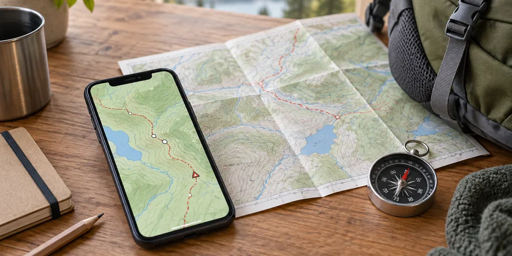
Your phone is one component of the plan. Bring enough battery for the trip plus delay, and consider a power bank in a protected bag. Keep the route file and a short written summary somewhere accessible without the mapping app. For unfamiliar or remote terrain, carry a suitable paper map and compass and know how to use them. Tell someone where you are going, when you expect to return, and what to do if you do not check in.
If you hike with a group, agree on one simple rule: stop at a junction when the group becomes uncertain. Do not let several people walk in different directions while trying to regain signal. Compare the map, route notes, terrain, and daylight. If the evidence does not agree, choose the conservative option and turn back or use the planned exit.
Troubleshoot before the trailhead
| Problem | Check first | Safer response |
|---|---|---|
| Map disappears offline | Was the region actually downloaded, and is the app showing the same account or device? | Re-download at home and run the airplane-mode test again. |
| Route line is present but no guidance | Offline routing may not be supported for hiking or that route type. | Use the line, landmarks, compass, and route notes; do not assume turn-by-turn guidance. |
| Storage is full | Inspect large map regions, photos, and old route files. | Remove unneeded downloads, then verify the new map opens offline. |
| Trail is missing | The map may have incomplete coverage or a different trail name. | Check an official source and carry a paper or second map. |
| Battery is falling quickly | Bright screen, GPS use, cold, and poor signal can increase drain. | Lower brightness, use battery-saving options, and keep the phone protected and charged. |
Finally, keep the download fresh without turning it into a false promise. Map data can improve, but a fresh download still cannot know every temporary obstacle. The dependable habit is: plan broadly, download early, test without signal, check current official conditions, carry a backup, and be willing to abandon the route when the information or conditions do not line up.
For related preparation, see the site’s guide to planning a week of meals and guide to backing up a computer.
Sources
Frequently Asked Questions
How much offline map should I download?
Download the entire route plus a generous margin around trailheads, junctions, bail-out roads, and likely detours.
Can I navigate every hiking route offline?
No. Offline map data may show your position and map features, but routing, traffic, live closures, search, weather, and map updates may be limited or unavailable.
Should I carry a paper map too?
For unfamiliar, remote, or consequential trips, yes. A paper map, compass, charged phone, and route notes reduce single-device failure risk.