Quick answer
Choose the smallest offline map that answers the survey’s real field questions: pick a basemap and data layers, define the whole working area with a margin, select enough zoom detail, confirm the device and app support the package, and test it without signal. For a volunteer team, a shared naming convention, a second copy, and a handoff plan matter as much as the map style.
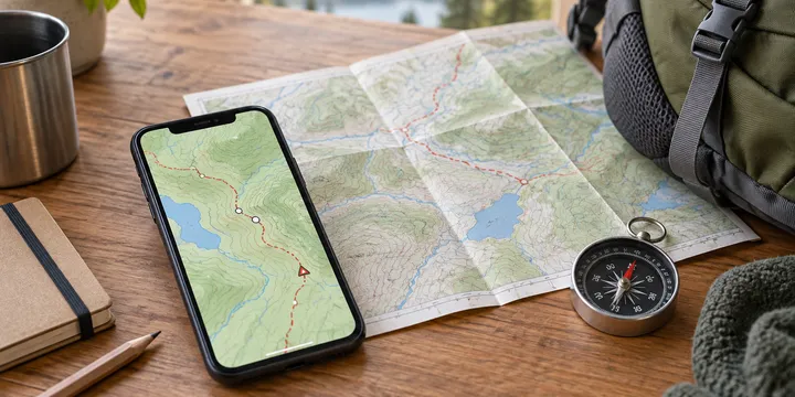
Choosing an offline map for a volunteer field survey is less about finding the prettiest basemap and more about matching a map to the work. A trail-monitoring group may need paths and access roads; a habitat team may need boundaries and reference layers; a community survey may need simple points and notes that another person can understand later.
The reliable sequence is: define the field decisions, choose the layers, size the area, select the detail level, check device limits, and test the complete workflow without a connection. This guide is app-neutral because menu names and supported formats vary. The official ArcGIS and ODK documentation linked below illustrate the constraints; they do not make one platform the right choice for every volunteer group.
Start with the survey questions
Write down what a volunteer must be able to do at the site. Keep the first version narrow enough that a phone screen remains usable in bright light, rain or gloves.
- Locate the access point and the survey boundary.
- Identify the feature being observed, such as a trail segment, stream crossing or tree plot.
- Record a point, line, polygon, note or photograph.
- Revisit a location using a route or waypoint.
- Explain the observation to someone who was not present.
This list determines the map. A route-only map can be enough for getting to a meeting point, but it is a poor choice if volunteers must distinguish property boundaries or habitat zones. Conversely, loading every available layer can make a small screen confusing and consume storage. Mapper.one’s field guidance makes the same practical point: agree on the decisions, layers and waypoint naming pattern before leaving coverage.
Use this selection table
The table turns the field questions into a manageable first choice. “Offline map” may mean a downloaded region in a navigation app, a basemap package attached to a survey, or a custom tile layer in a field-data app.
| Field need | Useful map content | Check before choosing |
|---|---|---|
| Reach a remote start point | Roads, trails, paths and route line | Does the route remain visible in airplane mode? |
| Record observations against a boundary | Basemap plus boundary or reference layer | Can the app show the layer and capture data together? |
| Inspect terrain or land cover | Contours, imagery or specialist reference layer | Is that layer licensed, current enough and readable at the working scale? |
| Repeat a transect | GPX route, waypoints and surrounding basemap | Can every device import and display the same file? |
| Hand work to another volunteer | Named points, short notes and exported data | Can the next person understand the names without you present? |
Treat a map package as a defined area and range of detail, not as a magical copy of the whole world. ArcGIS documentation explicitly says that the package’s geographical extent and required scale must be considered before creation. ODK likewise describes zoom ranges as a tradeoff: more levels can make a file larger, while a narrow range may hide detail when a volunteer zooms further in.
Choose a package that fits the devices
Ask the group what phones or tablets it will actually use. An office computer may create a sophisticated package that an older phone cannot display smoothly. ArcGIS Survey123 distinguishes Standard and Basic map types; its documentation recommends Standard for most devices, while Basic is intended for devices with display-performance problems and has a 2 GB limit for certain raster tile packages. That is a product-specific constraint, so check the current documentation for your chosen app rather than copying the number to another platform.
Common offline formats have different jobs:
- GPX is useful for routes, tracks and waypoints. It is not a complete basemap.
- GeoJSON, KML and KMZ can carry points, lines, boundaries or other reference features when the app supports them.
- MBTiles is a common way to carry raster or vector tiles into field-data applications such as ODK Collect.
- TPK, TPKX, VTPK and MMPK are ArcGIS package types documented for particular offline workflows.
Do not assume that a file is supported because its extension looks familiar. Check the app version, operating system, projection requirements and import path. ArcGIS’s preparation guide, for example, specifies Web Mercator Auxiliary Sphere for Survey123 offline basemaps and lists several ways to associate or copy a package. ODK’s guide explains that an MBTiles file can be transferred to devices, imported from storage, and selected for map questions, but also notes that vector tiles have rendering limitations depending on the basemap engine.
Size the area and detail level
Draw the real working area, then add a margin. Include the approach road, likely detours, a return route and nearby landmarks that help a volunteer orient themselves. A package that stops at the boundary may be technically complete and still fail in practice.
Next decide which zoom levels answer the survey question. Use a wider view to find the site and a closer view to identify a feature, but do not download every level automatically. More area and more detail usually mean a larger file, longer transfer and greater storage pressure. For a small group, record the choice in the survey handover:
Area: north reserve and access track; detail: overview for approach and close view for observation points; reference layer: boundary plus named plots; test date: before departure.
That short record makes it easier to reproduce the package and spot a stale map later. If the survey covers several separated sites, consider separate packages or named map areas rather than one oversized download that every device must carry.
Prepare and share it as a team
Choose one person to build or download the first package and one person to verify it on a second device. Share the exact file or map-area name, version date, coverage boundary and expected layers. Do not rely on a screenshot of a map: screenshots cannot usually be searched, switched between layers or used to record a location.
Before departure, open the map while connected, import the route or reference data, and inspect the start, middle and end of the work area. Then switch to airplane mode and repeat the checks. If the app supports offline collection, create a harmless test point or draft observation and confirm where it is stored. Delete the test only after confirming how real data will be exported or synchronized.
Keep a second copy of the route and survey instructions in the group’s agreed location. ODK documents several transfer methods, including file sharing, device-to-device transfer and manual placement on a device. The best method depends on when devices have connectivity and how comfortable volunteers are with the operating system. For a less technical group, a named download link plus a one-page setup checklist may be more reliable than asking everyone to browse a deep folder tree.
Test the failure cases
An offline map is ready only after it passes the conditions that matter in the field:
- Turn off mobile data and Wi-Fi, or use airplane mode as appropriate.
- Reopen the app and confirm the map is still present.
- Check the access point, a middle observation point and the exit route.
- Change to the close detail level used for observations.
- Confirm the location marker, route and reference layer appear.
- Record a test observation and verify its saved state.
- Check available battery and storage, then carry a backup plan.
If a blank area appears, do not immediately clear the entire cache. First compare the blank patch with the downloaded boundary, selected map source and zoom level. The troubleshooting sequence in the offline map tile guide explains why a missing tile, a wrong layer and a storage problem need different repairs. If your group is still planning the trip itself, the camping-trip planning guide can help keep transport, supplies and map preparation in one checklist. For GPX-specific handoff, see using GPX tracks without mobile coverage.
Know what the map cannot prove
Offline basemaps can show context and help a volunteer locate a saved feature, but they do not automatically make a survey accurate. Map currency, device GPS quality, position uncertainty, missing trails, projection choices and human recording errors still matter. A volunteer should record uncertainty honestly rather than treating a blue location dot as a precise boundary.
Also check licensing and attribution for the data source. OpenStreetMap-based maps, imagery and specialist layers can have different terms. Keep the source name and date in the handover so later editors know what they are looking at. For work where a dead battery or wrong turn has serious consequences, add a suitable paper map, compass, written directions or local safety procedure. The right offline map is the one that supports the field task, survives a no-signal test and leaves the next volunteer with understandable evidence.
Sources
Frequently Asked Questions
What is the best offline map for a volunteer survey?
There is no universal best map. Choose the source and package type that show the features your survey needs at the scales your devices can handle, then test the exact area and workflow offline.
How much area should an offline field map cover?
Cover the survey boundary plus access roads, detours, return routes and a practical margin. A map that covers only the observation points can fail before the team reaches them.
Should volunteers use a printed map as well?
For work where a dead battery, damaged phone or navigation error matters, carry a suitable paper backup and written handoff. An offline phone map is useful but is not a substitute for every safety plan.