Quick answer
Import the GPX while connected, download the full map area, verify the route on the device you will carry, and test it with mobile data and Wi-Fi disabled. GPS can still position you, but live maps, searches, server routing, and updates may not work.
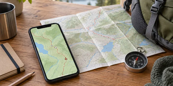
Using a GPX track outside mobile coverage is less mysterious than it first appears. The phone needs three different things: the track file, a map stored locally, and enough battery to keep the display and location services available. GPS positioning can continue when the phone cannot reach a cell tower, but an app cannot download a missing map tile or calculate every new route from the middle of a valley.
The reliable workflow is to import the GPX while connected, download the complete map area, inspect the file on the device you will carry, and test the same setup with Wi-Fi and mobile data disabled. That short test exposes the common failure: the blue location dot still works, but the map underneath it is blank.
Understand what the GPX contains
A GPX file can contain tracks, routes, and waypoints. A track is usually a line made from many recorded or planned points. A route may be a sequence of intended stops or turns. A waypoint is a named place such as a trailhead, junction, water source, or exit. Mapping apps do not always display or navigate these objects in the same way.
That distinction matters in a dead zone. An imported track may remain visible as a breadcrumb line without providing spoken turn instructions. Some apps can calculate a new route only through an online service. Treat the file as the path you brought with you, not as a promise that the app will reroute around every mistake.
Prepare the file before leaving
Save the original GPX somewhere local and open it in the mapping app you intend to use. Do not wait until the trailhead. Check the following:
| Check | What to confirm | If it fails |
|---|---|---|
| File opens | The app accepts the GPX and shows a track or route | Try the app’s Import/Open command and keep the original file |
| Shape | The line is in the intended place and follows a plausible path | Compare the start, finish, crossings, and obvious bends with another source |
| Waypoints | Important junctions, exits, and water points have useful names | Add only practical points; avoid sharing sensitive home locations |
| Distance | The length and elevation make sense for the group and daylight | Recheck units, split the trip, or choose a shorter option |
| Coverage | The route and likely detours fit inside downloaded map areas | Expand the download before leaving Wi-Fi |
Zoom into the start, finish, and several middle sections. A file can be valid XML and still contain the wrong trip, an accidental drive to the trailhead, or a straight jump caused by missing points. If the app offers a validator or statistics view, use it while connected. Keep a separate copy of the original if you simplify or edit the track.
Download more than the line
The GPX supplies geometry; the basemap supplies context. Download the whole route with extra area around the trailhead, junctions, exits, and realistic detours. A narrow strip or a single starting tile may leave you with a line that disappears as soon as you take one wrong turn.
While connected, open the offline-map controls and wait for the download to report completion. If the route crosses a regional boundary, check every region. Include the map detail you need for the activity, such as paths or contours, and note that satellite imagery and live overlays may remain online-only.
Do not assume that a screen you viewed earlier is a complete offline cache. Close and reopen the app if practical, then test the route after the map download finishes. The exact menu names vary between Organic Maps, OsmAnd, Gaia, Ride with GPS, and other apps, so the destination device is the authority—not a tutorial for a different app.
Run the no-network test
At home, before the trip, disable Wi-Fi and mobile data. Airplane mode is a useful stronger test, but check that Location Services remains enabled on your phone. Then:
- Reopen the mapping app and wait for a location fix in a place with a reasonable view of the sky.
- Pan across the start, middle, finish, and likely exit points. Confirm that the basemap still renders.
- Confirm that the GPX line and named waypoints remain visible.
- Check whether the app can show your position on the line and what happens after you move away from it.
- Record which features disappear: search, live traffic, satellite imagery, weather, sharing, or new-route calculation.
If the location dot appears on a grey screen, the GPS is not necessarily broken. The map area was probably not downloaded, or the selected layer streams from the internet. If there is no location, check the app permission and system Location Services first. A first fix can take longer without assistance data; move into open sky and wait rather than diagnosing the GPX.
Make the battery and backup plan explicit
GPS itself is only part of the power budget. A bright screen, frequent map panning, cold weather, and a phone searching for a network can drain the battery quickly. Use airplane mode when it is safe to do so, lower brightness, check the map at decision points, and carry a charged power bank. Keep the phone warm in cold weather and protect it from rain.
For a remote or consequential trip, keep a paper map and compass and know how to use them. Tell someone the route, expected return time, and planned exits. A GPX track is an aid to navigation, not proof that a path is open, safe, legal, or suitable for the weather and the group. Check current closures, access rules, daylight, and conditions separately while connected.
Troubleshoot by separating the layers
When offline navigation fails, test one layer at a time:
- The map is blank but the position works: download a wider vector-map area and switch away from online-only imagery.
- The line is missing: reopen or re-import the GPX, then verify that the app saved it locally rather than merely displaying an attachment.
- The line is in the wrong place: compare its start and coordinate system with a known map; do not try to fix it by changing the phone’s location.
- A new route cannot be calculated: expected for apps whose routing runs on a server; follow the imported track or wait until coverage returns.
- The first position takes a long time: give the receiver open sky and time for a cold start.
- The battery falls quickly: use airplane mode, reduce screen time, and switch to the backup plan before the phone reaches an unsafe level.
Final departure checklist
Before leaving coverage, confirm that the GPX is on the actual phone or GPS unit, the complete map corridor is downloaded, the route and waypoints display, and the airplane-mode test succeeded. Keep the original file in a second location, carry power, and know what you will do if the device breaks. If you are starting from a phone-based trip workflow, see how to download offline maps for a hiking trip. For a Linux-first preparation process, see how to plan an offline hiking route on Linux.
Sources
Frequently Asked Questions
Does GPS work without mobile coverage?
Usually yes. The phone's receiver can listen to satellites without a SIM or data connection, but the map, search, live traffic, and server-based routing may need to be prepared or unavailable.
Is a GPX track the same as turn-by-turn navigation?
No. A track is a line of recorded or planned coordinates. An app may display it without offering turn instructions or offline rerouting.
How do I know my offline map is ready?
Disable Wi-Fi and mobile data, reopen the app if practical, pan around the complete route, and confirm that the basemap, GPX line, waypoints, and location still appear.